
Quick answer
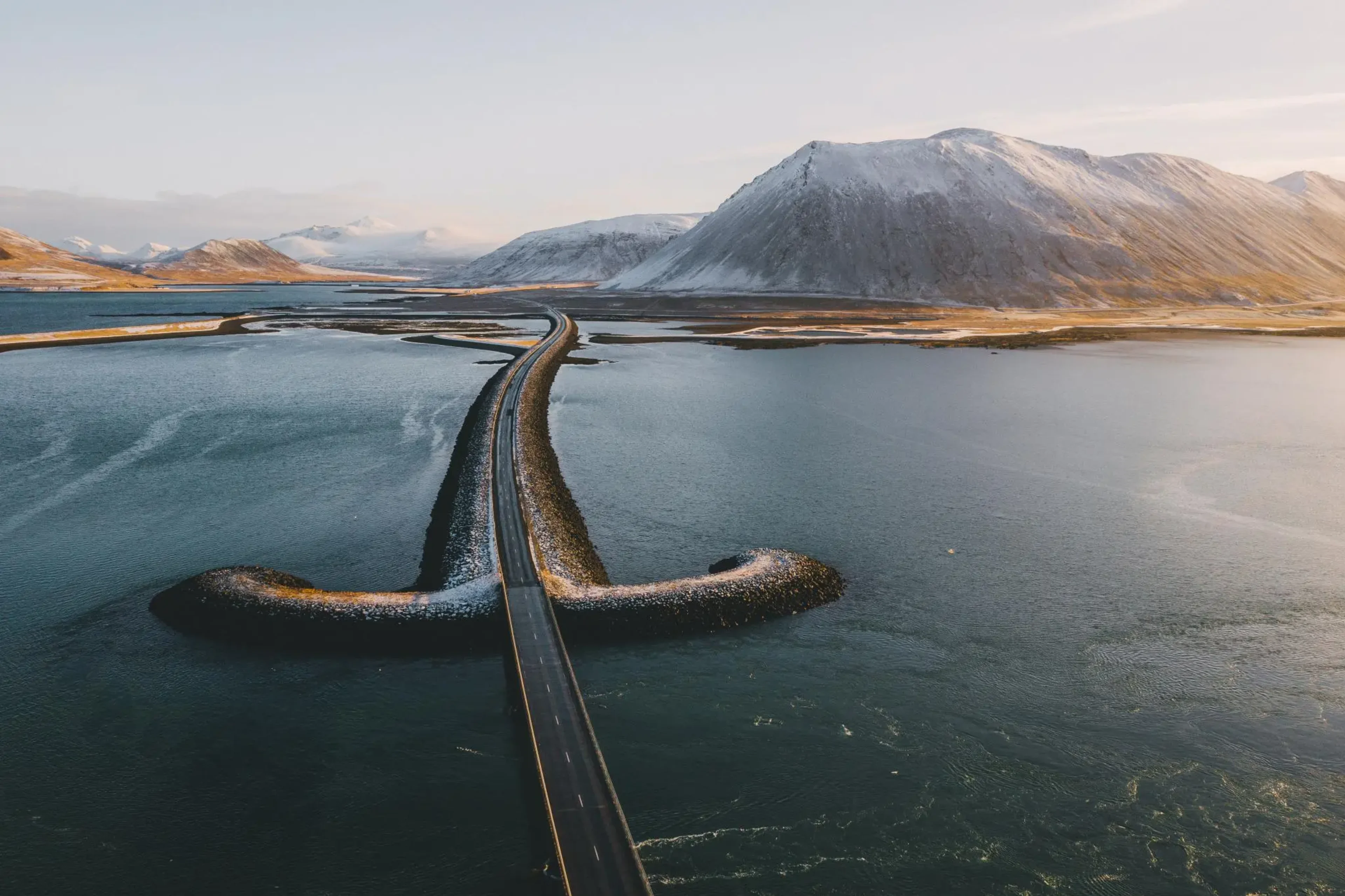
The distance from Reykjavik to Akureyri is 388 kilometers (241 miles) via Route 1, Iceland's Ring Road. Under normal summer conditions, the drive takes approximately 4.5 to 5 hours without stops. Winter weather, road work, and detours through Eyjafjörður can extend that time by an hour or more, and most travelers add stops at Hvammstangi, Blönduós, or the Vatnsnes Peninsula along the way.
Route 1 carries nearly all traffic between Iceland's capital and its northern hub, and the 388-kilometer span between Reykjavik and Akureyri represents the backbone of the country's internal travel network. The road runs north from the Reykjavik metro area, tracing the western coast through Borgarfjörður, crossing the glacial outwash plains of Holtavörðuheiði, and threading a series of peninsulas and fjords before descending into Eyjafjörður and Akureyri itself. The route is fully paved, two lanes for most of its length, and open year-round, though winter sections above 300 meters can close temporarily during storms. Driving time under optimal conditions sits between 4.5 and 5 hours, but few travelers cover the span in one unbroken push. The western leg from Reykjavik to Blönduós accounts for roughly 250 kilometers and three hours; the remaining 138 kilometers to Akureyri wind through higher terrain and tighter curves, adding another 90 minutes. Fuel is available in Borgarnes, Blönduós, Varmahlíð, and several smaller settlements, with intervals rarely exceeding 70 kilometers. Mobile signal is strong in populated areas but drops out across the highland plateau stretches and parts of the Vatnsnes and Skagafjörður coastlines. The distance from Reykjavik to Akureyri becomes the foundation for planning any Lake Myvatn itinerary, as the lake lies another 103 kilometers east of Akureyri along Route 1—roughly an hour beyond the city. Many visitors split the journey into two days, overnighting in Akureyri or continuing directly to the Myvatn basin and using the northern capital as a supply and service stop on the return leg. The stretch between Akureyri and Myvatn passes Goðafoss waterfall at the 45-kilometer mark, a near-mandatory stop that adds 20 to 30 minutes. Road conditions east of Akureyri mirror those of the western approach—paved, well-marked, and susceptible to crosswinds and reduced visibility during shoulder seasons. Route 1 alternatives exist but add distance and unpredictability. The Kjölur highland route (F35) cuts through the interior plateau and reduces the crow-fly distance, but it remains closed from September through mid-June, requires a 4x4 vehicle, and offers no services for 170 kilometers. Domestic flights between Reykjavik and Akureyri take 45 minutes, eliminating the drive entirely but removing the flexibility to visit Myvatn and the northern attractions that make the overland journey worthwhile.
“Route 1 carries nearly all traffic between Iceland's capital and its northern hub, and the 388-kilometer span represents the backbone of the country's internal travel network.”
Calculating the Distance From Reykjavik to Akureyri and Onward to Lake Myvatn
The journey from Reykjavik to the Lake Myvatn area spans approximately 480 kilometers along the Ring Road (Route 1). Most travelers drive to Akureyri first, which takes about 5 hours, before continuing east for an additional 90 minutes to reach the Myvatn region.
Route 1 (Ring Road) from Reykjavik to Akureyri
Route 1 from Akureyri to Myvatn
Strætó line 57 from Mjódd station to Akureyri
Best Time to Travel the Distance From Reykjavik to Akureyri and Myvatn
The period from late May to early September offers the safest road conditions for the long journey between Reykjavik, Akureyri, and Lake Myvatn. Arriving at the lagoon during the best arrival window of 10:00–12:00 ensures a more personal experience by avoiding peak afternoon congestion.
Summer (June–August)
HighMild, 8°C to 15°C. Long daylight hours provide flexibility for travel.
Shoulder (May, September)
ModerateVariable, 3°C to 10°C. Roads are generally clear with fewer travelers.
Winter (October–April)
LowCold, -5°C to 3°C. Frequent snow and ice require significant caution on Ring Road sections.
Weekday mornings
Low—
Arriving at 10:00 helps bypass afternoon tour groups and congestion.
Verdict: The most effective travel window is mid-week in September, arriving at the lagoon between 10:00–12:00 to balance road safety with manageable visitor numbers.
Opening Hours for Services After the Distance From Reykjavik to Akureyri
The Earth Lagoon maintains a consistent daily schedule throughout the week to accommodate visitors traveling from the capital region to the Lake Myvatn area.
| Monday | 10:00–23:00 | |
|---|---|---|
| Tuesday | 10:00–23:00 | |
| Wednesday | 10:00–23:00 | |
| Thursday | 10:00–23:00 | |
| Friday | 10:00–23:00 | |
| Saturday | 10:00–23:00 | |
| Sunday | 10:00–23:00 |
Nearby Sights After Traveling the Distance From Reykjavik to Akureyri
The Lake Mývatn area features high-density geologic sites that complement a visit to the Earth Lagoon. Exploring these natural landmarks provides geographical context to the diverse volcanic landscape of Northern Iceland.
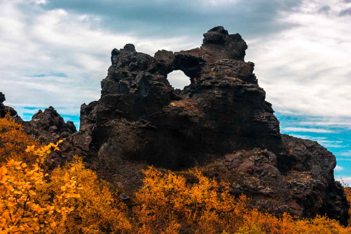
Dimmuborgir
These extensive lava formations offer walking paths through solidified structures that contrast with the geothermal waters.
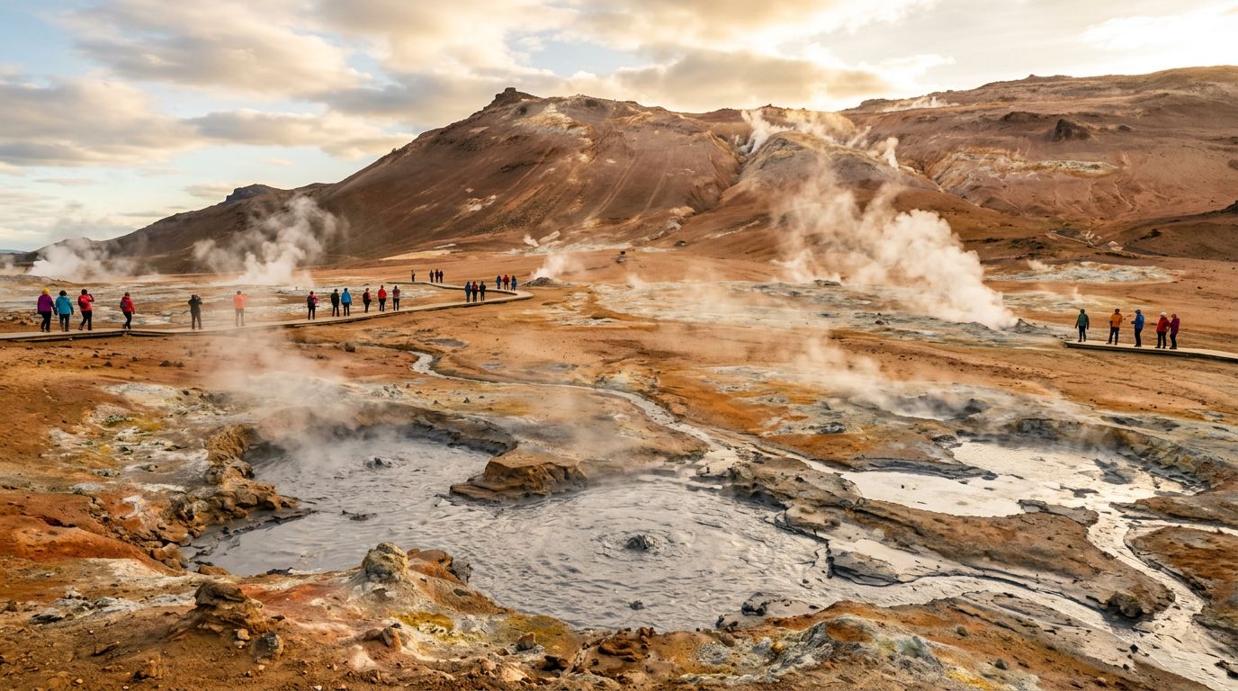
Hverir Geothermal Area
This site features bubbling mud pools and steaming fumaroles that showcase the intense volcanic activity characterizing the Mývatn region.
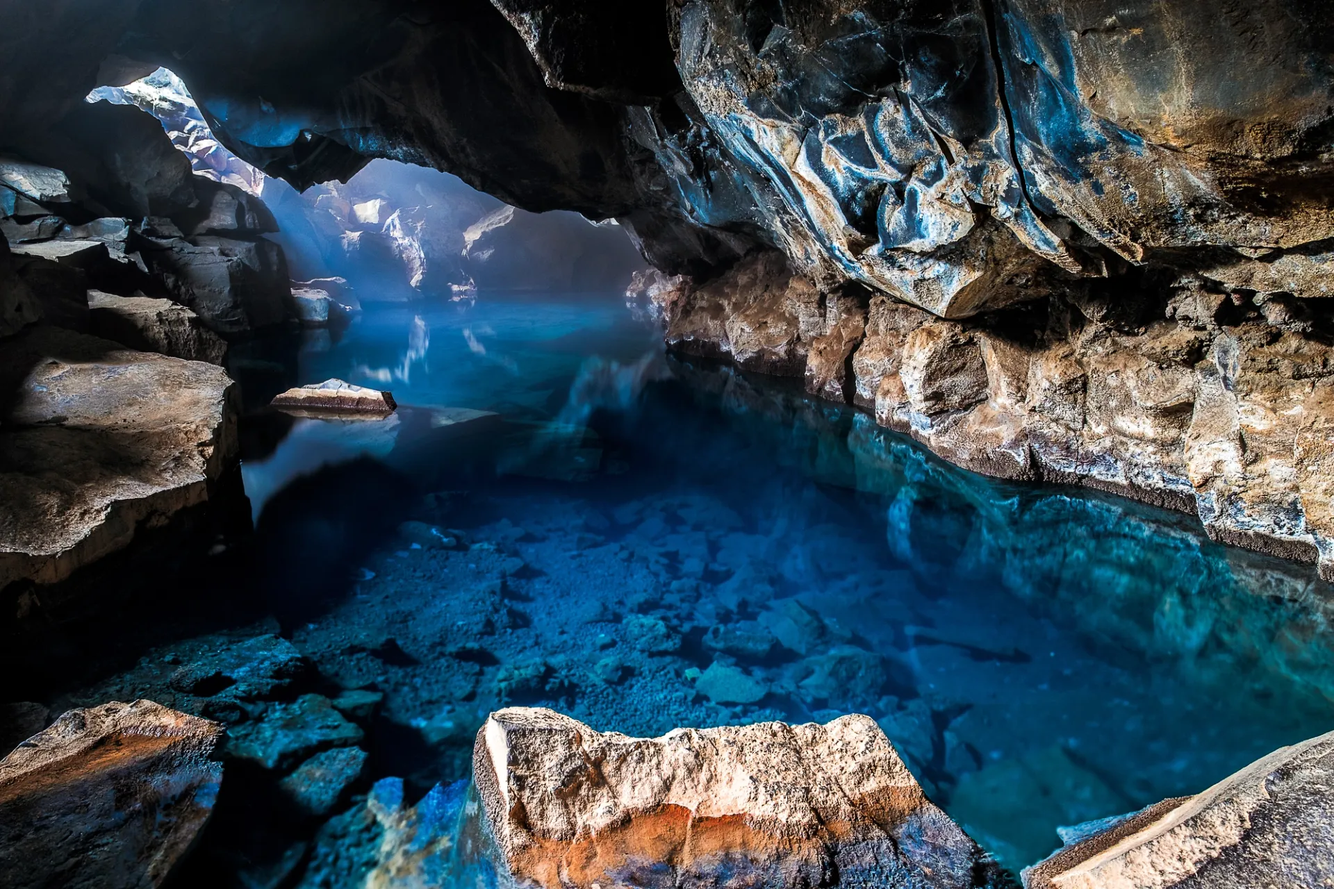
Grjótagjá Cave
A small lava cave containing a thermal spring, this location provides a look at the subterranean geology found near the main geothermal sites.
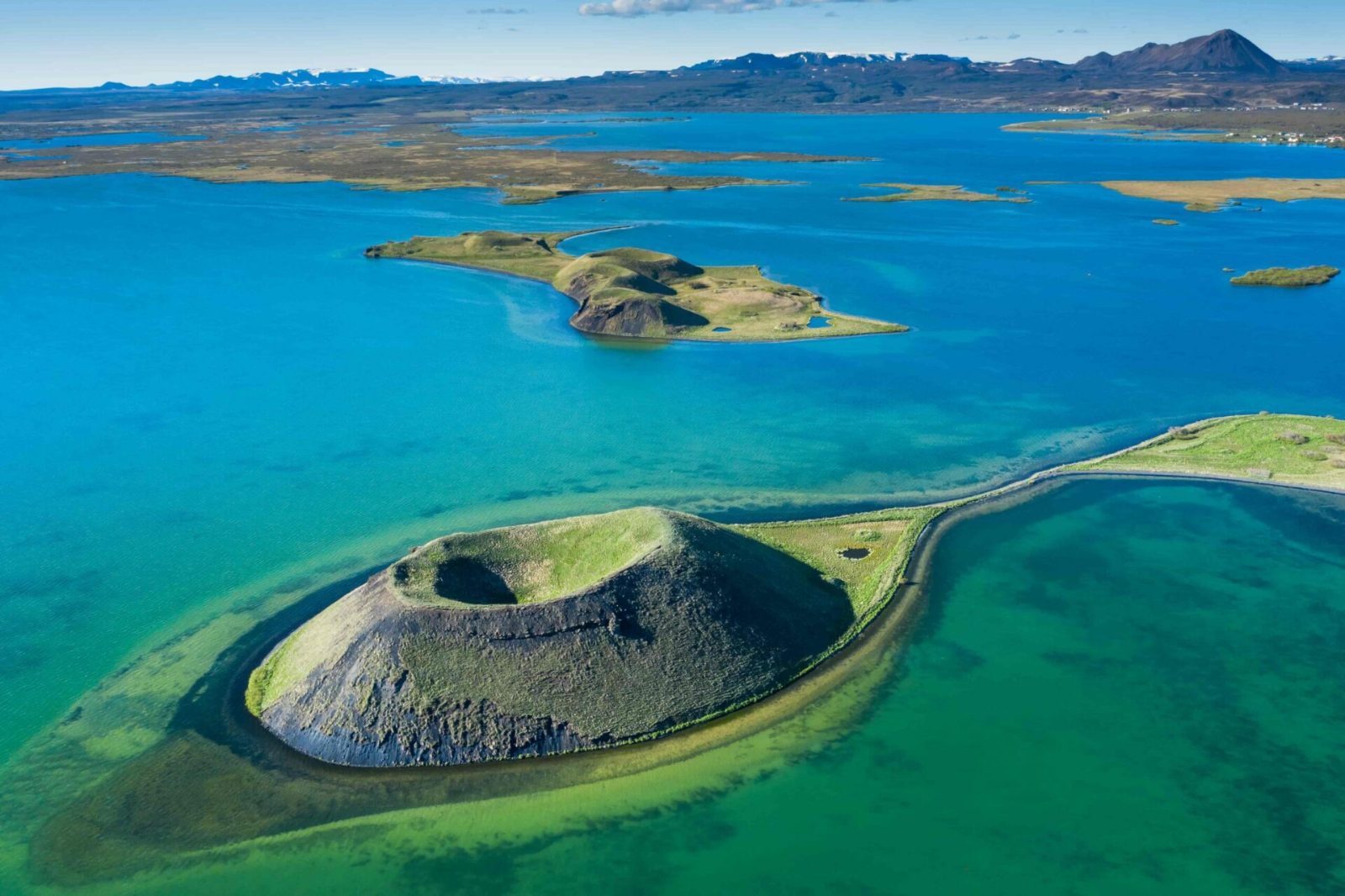
Skútustaðagígar
These pseudo-craters formed by gas explosions are situated around the lake, offering accessible trails with views of the surrounding wetlands.
Check availability
Frequently Asked Questions: Distance from Reykjavik to Akureyri
Everything you need to know about distance from reykjavik to akureyri